Port-Gentil
Port-Gentil or Mandji is the second-largest city of Gabon, and it is a leading seaport. It is the center of Gabon's petroleum and timber industries. The city is located on a delta island in the Ogooue delta with no bridges to the mainland. Nearby Cape Lopez is Gabon's westernmost point. As of 2013 census, it had a population of 136,462.
In 1473, the Portuguese navigator Lopo Gonçalves sailed near Cape Lopez. In 1722, pirates led by Bartholomew Roberts fought a battle in the Cape Lopez Bay against the Royal Navy. The encounter ended in Roberts' death. The settlement was established on Mandji Island in the delta of the Ogooué River by the French, who signed a treaty with the Orungu people in 1873. It was used as a base for the expeditions of de Brazza into the interior, then in 1894 a customs post was set up, becoming the nucleus of a trading center that included Hatton & Cookson, John Holt, Woermann, Société du Haut-Ogooué, and Compagnie d'Exploitations Forestières Africaines. The main products were initially rubber and ivory, gradually supplemented by woods, particularly okoumé for plywood. The town was named after the French colonial administrator Émile Gentil in 1900. After World War I it became a port for timber, but it grew rapidly only after Elf began oil exploration in the area. It received its first bank branch when Bank of West Africa (BAO) opened a branch there in 1928.
The city was the location of the exile of Moroccan nationalist leader Allal al-Fassi who resided in the city between 1937 and 1946.
A 1947 population of 4,500 grew to 21,000 by 1960. An oil refinery was established by SOGARA in the 1960s, with natural gas added in 1968.
The town is now known for its hotels and its nightlife, while attractions include the St Louis Church (built in 1927), a zoo, a casino, beaches and a golf course, as well as the wildlife in local swamps.
Map - Port-Gentil
Map
Country - Gabon
 |
 |
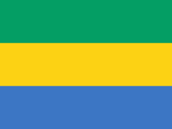
| Flag of Gabon | |
Since its independence from France in 1960, the sovereign state of Gabon has had three presidents. In the 1990s, it introduced a multi-party system and a democratic constitution that aimed for a more transparent electoral process and reformed some governmental institutions. Despite this, the Gabonese Democratic Party (PDG) remains the dominant party. With petroleum and foreign private investment, it has the fourth highest HDI in the region (after Mauritius, Seychelles and South Africa) and the fifth highest GDP per capita (PPP) in all of Africa (after Seychelles, Mauritius, Equatorial Guinea and Botswana). Its GDP grew by more than 6% per year from 2010 to 2012.
Currency / Language
| ISO | Currency | Symbol | Significant figures |
|---|---|---|---|
| XAF | Central African CFA franc | Fr | 0 |
| ISO | Language |
|---|---|
| FR | French language |


